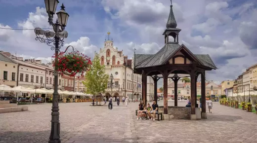
The route leads to historical landmarks dating from the 16th to the 19th century. Many of them were preserved in very good condition or have been thoroughly restored. Today they hold museums, various cultural institutions, hotels, as well as seats of governmental agencies and local authorities
The Route of Lubomirski Family Estates starts in Stalowa Wola and ends in Podolínec in Slovakia (the total length is 488 km). The itinerary comprises 18 locations, including nine former Lubomirski family nests; the remaining places are noteworthy because of their links with the Lubomirski family (even though no significant traces of those times have been preserved); they are also interesting for other historical landmarks.
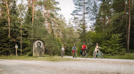
Another noteworthy fact is that the route leads through geographical areas with diverse landscapes and natural qualities. The fragment between Stalowa Wola and Rzeszów leads through the flatlands of the Sandomierz Valley, situated between the rivers Vistula and San, with elevations ranging in altitude from 143 to 266 metres. After all, the area is not quite monotonous and homogenous. In its northern and southern parts there are wide marshy plains, and in the central areas dune-like elevations add variety to the landscape. Then from Boguchwała, via Rzeszów, Łańcut, Przeworsk and further on to Przemyśla, the route leads along the foothills of the Carpathians. The fragment from Przemyśl to Sanok leads through the picturesque areas of the Przemyśl-Dynów Foothills and the Słonne Mountains, passing by the tallest elevation along the trail, 620 metres above sea level. The area, located within the Carpathian Foothills, features numerous ranges of hills with altitude from 300 to 600 metres. Other notable attractions here include the valleys of the rivers Wisłok, Wisłoka and San. Further on, from Sanok to Miejsce Piastowe, the route leads through the varied area called Jasło-Sanok Valleys. From Miejsce Piastowe via Dukla the route leads along the Low Beskid mountains as far as the Dukla Pass, and at this point it crosses the border between Poland and Slovakia (Barwinek – Vyšný Komárnik). The Low Beskid, situated on both sides of the border, is a long range of mountains, covered with forests and featuring dome-shaped summits 600–900 m in height. Later, in Slovakia the route leads along the southern foothills of the Carpathians, in the western part of the Ondavská Highlands (Svidník – Bardejov), and as far as Spiš (Stará Ľubovňa and the last stop along the route – Podolínec).
The most important landmarks along the route are located in the former estates of the Lubomirski family. These are: Rozwadów and Charzewice – old manorial buildings (in Charzewice), an edifice known as ‘the castle’ (in Rozwadów), church and monastery of the Order of Friars Minor Capuchin; Baranów Sandomierski – park and castle complex, church of St. John the Baptist from the late 16th/early 17th century; Boguchwała – palace from 1728, parish church from 1729; Rzeszów – castle, summer palace (1712), old Piarist college and monastery, Bernardine monastery complex, town parish church of Saints Stanislaus and Adalbert; Łańcut – castle complex with a 33 ha park (16th century), Romantic castle (1805), Dominican monastery from the late 15th/early 16th century, neo-Gothic church of St. Stanislaus from 1488; Przeworsk – palace and park complex from the late 18th century, Bernardine monastery (1461), cloister of Daughters of Charity from the 1700s; Przemyśl – palace and park from the 1800s, Dominical convent (1595), Franciscan church of St. Mary Magdalene (1778), and building of Jesuit college of St. John the Baptist (1635).
Length of the Route: approx. 488 km
Photo: Agnieszka Kołodziej
Sprawdź podobne