The trek begins from the car park at the checkout point of the Bieszczady National Park (BdNP)
ROUTE
Wyżniańska pASS - PTTK hut near Mała Rawka - Mała Rawka - Wielka Rawka - Kremenaros - WIelka Rawka - Ustrzyki Górne
DISTANCE
12 km
DIFFERENCE IN ALTITUDE
+730m/-880m
ESTIMATED TIME
4h 10min
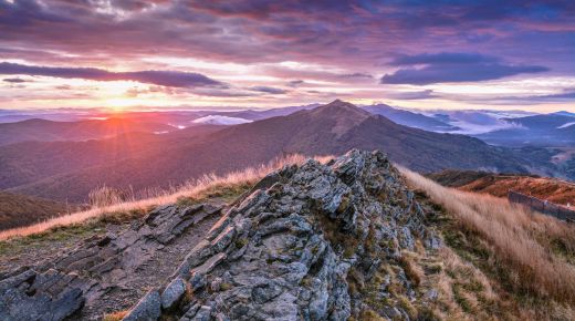
We follow the gravel road along the green markings of the tourist trail. We reach the PTTK hut at Mała Rawka. We reach Mała Rawka by a steep path, and then follow the yellow trail to the south to reach the peak of Wielka Rawka. Going further, we come to a fork in the trail. We choose the southern direction and follow blue signs to go down to the pass. We approach Krzemieniec (also called Kremenaros), where there is a characteristic pole marked with three borders. From here we have the opportunity to descend to Nowa Siedlica in Slovakia or follow the border route to Rabia Skała. We come back the same way to a fork in the trail at Wielka Rawka. We go down the Blue Carpathian Trail to the BdNP checkout point at the large Bieszczady bypass. From here, we have a 3 km road to the centre of Ustrzyki Górne.
GOOD TO KNOW
The section between Wielka Rawka and Krzemieniec runs along Polish-Ukrainian border posts and is the only fragment of the borderline in Poland made available for tourist traffic.
Krzemieniec (1221 m n.p.m.) is the highest peak of the slovak Bieszczady (Bukovské Vrchy).
The red trail from Nowa Siedlica to Krzemieniec is the steepest section in the Bieszczady Mountains. Over a distance of 10 km we cover 970 m of steep paths.
Photo: Damian Berlik


.jpg)
